under construction
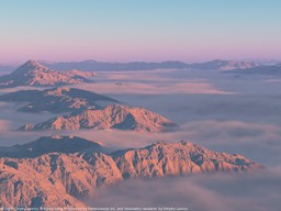
(it is not reference photo. It is 100% computer-generated picture, rendered with Volumetrics and using Erosion Fractal for terrain shape.)
Introduction:
Erosion is very important for realistic modelling of terrains; nearly all landscape
features on the Earth and other rocky planets have been eroded by fluid flows(water or wind), and/or
by thermal stress.
Existing erosion simulation techniques can generate fairy accurate erosion effects on terrains,
but the methods used (simulation on height grid) generally works on one scale and do not
produce arbitrary level of detail on demand.
The procedural terrain generation techniques, on other hand, can give arbitrary details
(e.g. multifractal terrain models based on perlin noise), but do not incorporate erosion.
So, it's not surprisng that computationally practical fractal erosion has long been a
'holy grail' of procedural terrain modelling.
This page presents novel fractal erosion and deposition algorithm I'm currently working on.
Algorithm is highly flexible; it computes erosion-modified landscape for given procedural
heightfield (it can also be used to add small scale details to DEM, that will be consistant
with large scale details). Algorithm is relatively computationally inexpensive and can be used
in e.g. computer graphics on today's personal computers. It should be possible to create
more optimized implementations.
It really defines a fractal; it is self-similar, and can be practically zoomed in as much as
you want (it is indeed possible to change type of self-similarity and "fade out" erosion at smaller
scales, if necessary, to simulate real terrain where small scale erosion is often
prevented by vegetation).
The self-similarity can be controlled; parameters can be made to be different at
different scales, to achieve maximal realism.
Similar methods could potentially be used to make realistic wind erosion and material
redistribution (such as formation of dunes) and thermal erosion. It appears to be possible to
"fit" parameters of the model to match existing real-world data; it would open practical
uses in erosion control and geophysics in general.
I'm writing more technical paper on subject; this is just outline of few experimental results
and future possibilities that will probably go into "abstract" of paper.
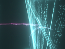
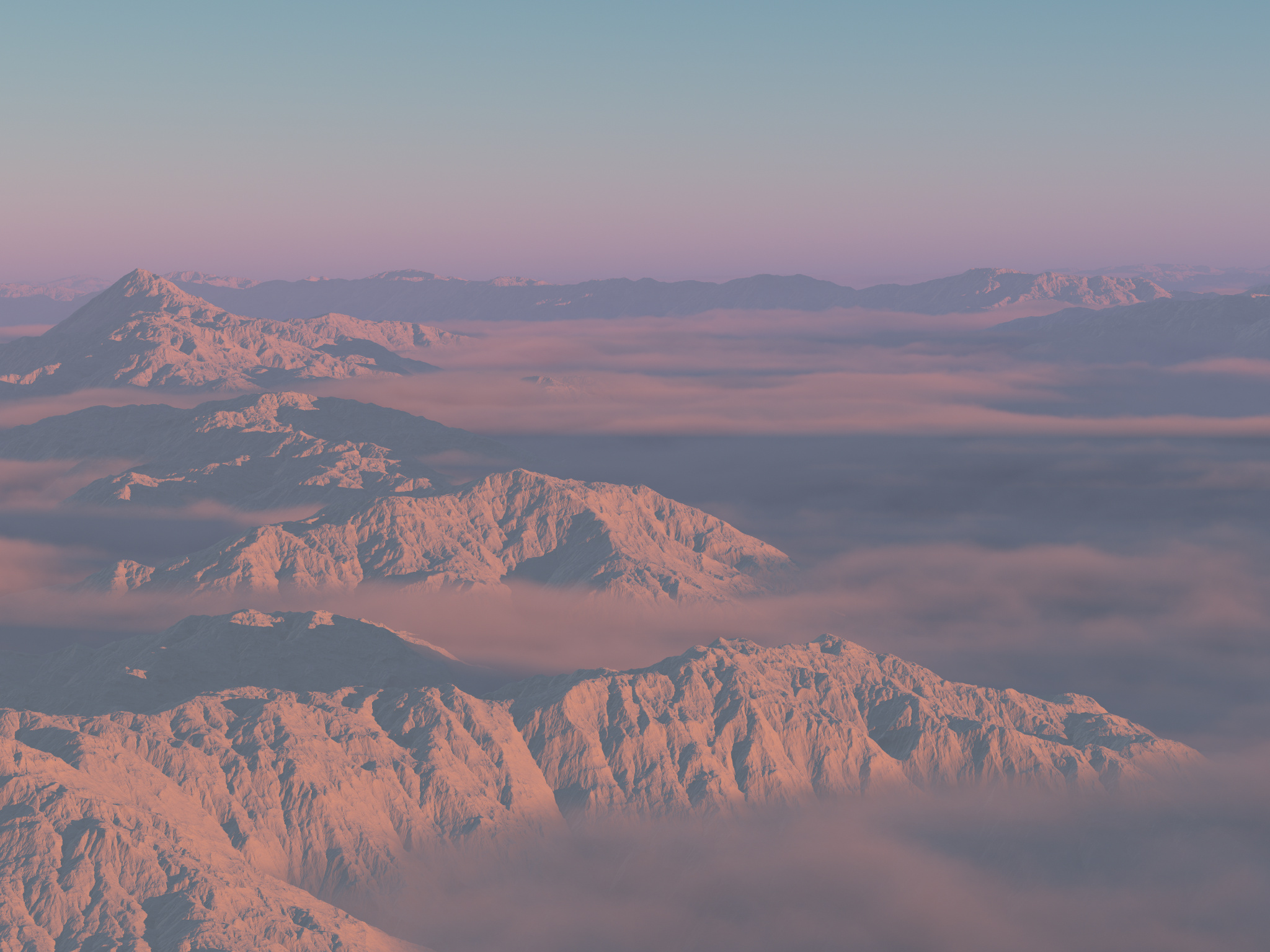
Test movie.
Demonstration of zooming the fractal in(rendered using Volumetrics):
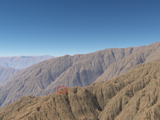

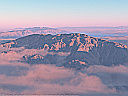
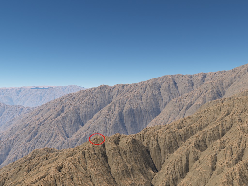
Some sample base procedural terrain:
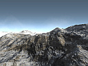
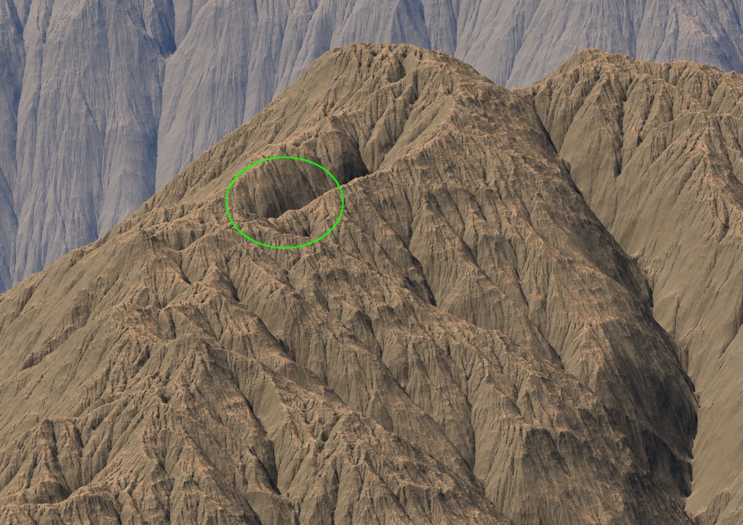
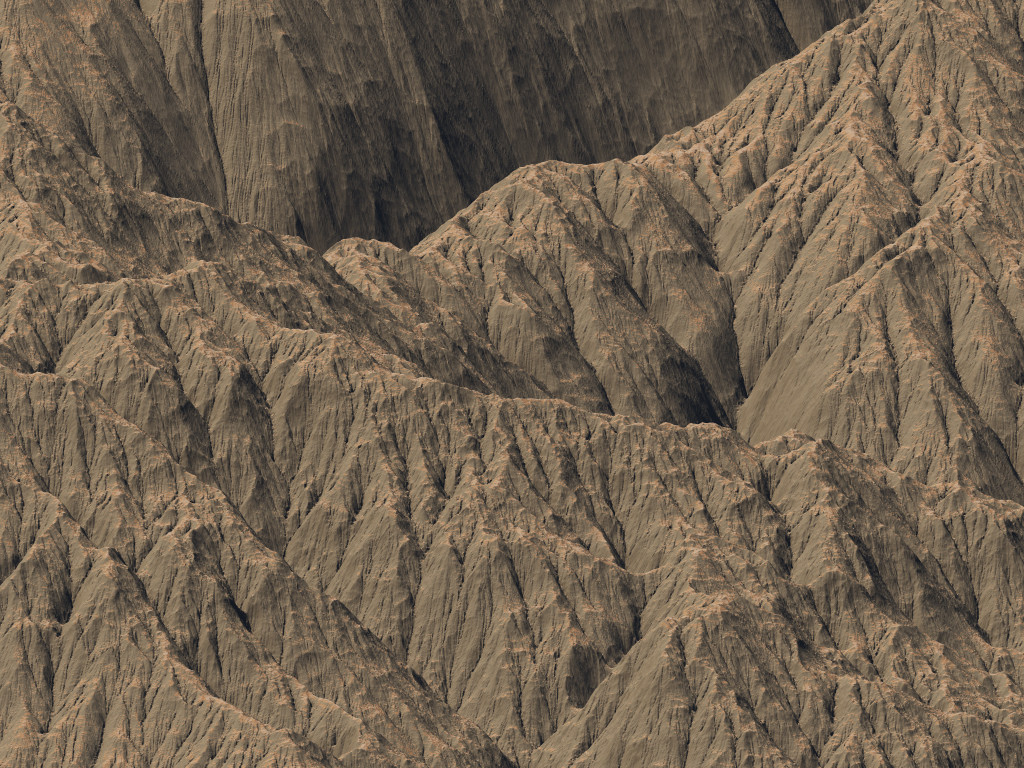
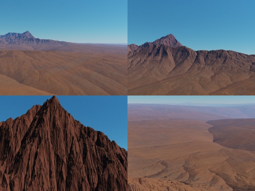
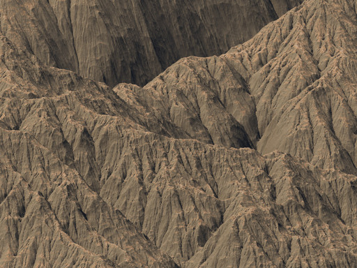
and erosion fractal with same terrain at input (note: large scale erosion has been blocked
to preserve original terrain enough to see resemblance.
So that's why there's only mid-scale erosion visible):
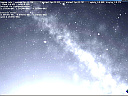
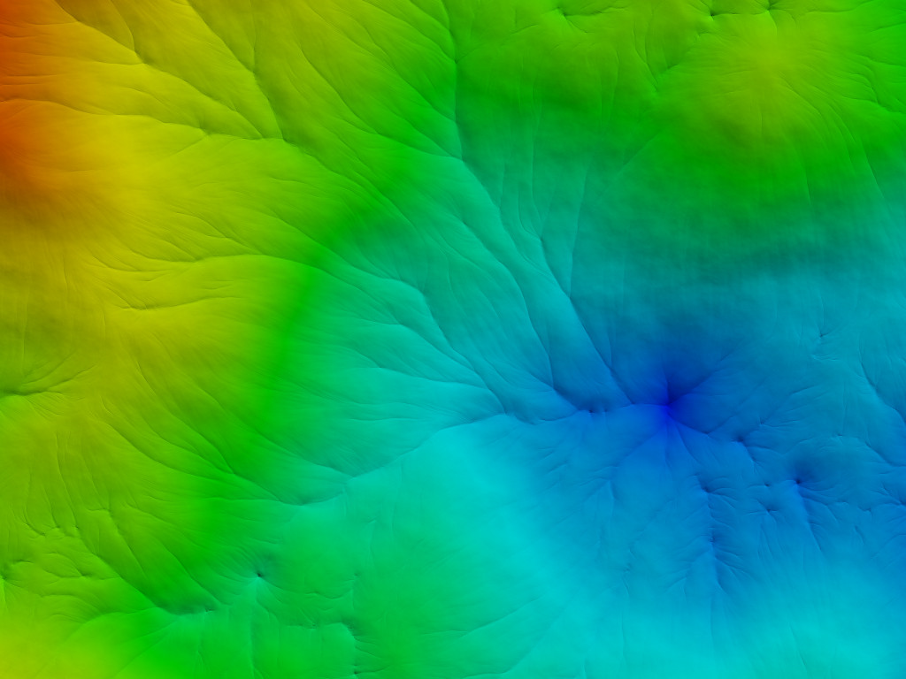
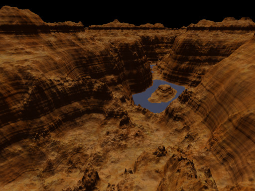
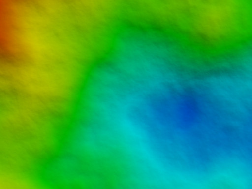
Another example, view from above, flatter monofractal terrain. Colored by altitude, red for higher altitude, blue for lower:

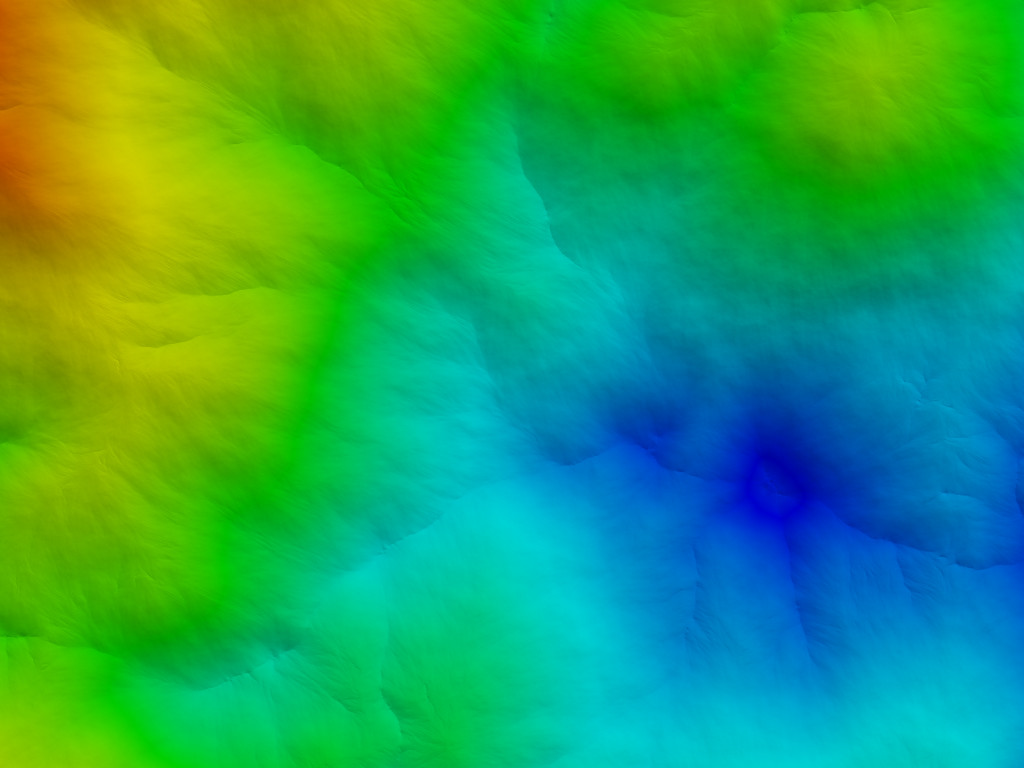
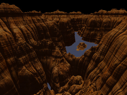
Same landscape eroded with different settings: